Restored Floodplain Helps Heal Mississippi River
Published on by Water Network Research, Official research team of The Water Network in Academic
John White and his colleagues at LSU research ways to remove pollutants from the river. One method is reconnecting the river to the floodplain.
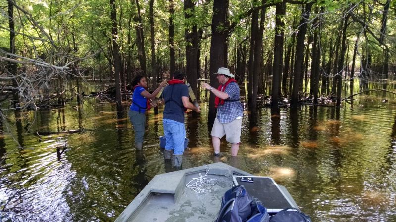
Hurst, Chris Rice and White sample soils in a bottomland wetland forest, an ecosystem that's been reduced by 80 percent in the lower Mississippi Valley. Credit: Photo credit Joseph Baustian , The Nature Conservancy.
Huckleberry Finn wouldn't recognize today's lower Mississippi River. Massive walls separate the river from low-lying lands along the bank, an area called the floodplain.
Floodplains were once the spillover zone for the river. As people settled in floodplains, the land was converted into farms, homes, and businesses. Close to 1,700 miles of walls, or levees, keep the lower Mississippi River in check.
"It's less of a river and more of pipe now," says John White, a coastal scientist at Louisiana State University (LSU).
Over the last century, the amount of chemical pollutants, in particular nitrogen fertilizer, in the river increased dramatically. When the river reaches the Gulf of Mexico, the pollutants create a low oxygen "dead zone" covering over 5,000 square miles. That's partly because the Mississippi River is missing one of its main filters: the floodplain.
White and his colleagues at LSU research ways to remove pollutants from the river. One method is reconnecting the river to the floodplain. As rivers flow into floodplains they carry soils with them, creating a wetland. Wetlands trap chemical pollutants like nitrogen.
The low oxygen and high organic matter in a wetland create a unique environment. As bacteria adapt to this environment, they convert fertilizer nitrogen into a benign nitrogen gas.
"There's a whole subset of microorganisms that do this," says White. "You just have to get the process going."
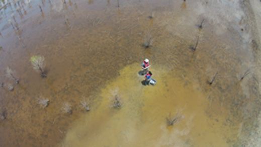
White and Hurst sample soils from Mollicy Farms, a restored wetland along a tributary of the Mississippi River. Credit: Photo credit Joseph Baustian , The Nature Conservancy.
Reconnecting the river to the floodplain isn't likely for most of the lower Mississippi valley, which runs from the Gulf of Mexico to northern Arkansas and Tennessee. However, a farm along one of the Mississippi's tributaries recently became a floodplain on accident. The levee next to the farm broke in two places and flooded the area.
Fortunately, the U.S. Fish and Wildlife Service (USFW) had plans with the farm to break the levee and added another 4 breaks the following year to speed up the process. The USFW and The Nature Conservancy were already in the process of recreating a hardwood forest wetland on the farm. This type of ecosystem once covered most of the region, but only 20 percent remains.
It was a perfect opportunity for White and his graduate student, Nia Hurst, to study how the restored site compares to a natural floodplain. He and his team measured the levels of nitrogen removal from both the farm and a nearby forested wetland. The group also compared the soil properties of the two sites.
Read full article at: Phys.org
Media
Taxonomy
- Watershed Management
- River Studies
- Watershed
- Wetlands
- River Engineering
- Flood management
- Watershed Management
- Flood
- Wetlands